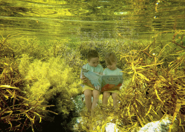
A new online portal will give researchers access to valuable data collections about Victoria’s seafloor and coastal ecosystems.
Deakin University is leading a collaborative project to collate marine data that might otherwise be lost to the scientific community, and archive it in an accessible form.
The Victorian Marine Habitat Mapping (VMHM) project, led by researchers from Deakin’s School of Life and Environmental Sciences and staff from Deakin Library and Deakin eResearch, aims to bring together data on Victoria’s marine habitats from around the State and make it available to current and future researchers through the Victorian Marine Data Portal.
Funded as an Australian National Data Service (ANDS) “High Value Collection” project, the portal will enable marine habitat researchers to share data and access curated data sets from Deakin, the Victorian Government and other agencies.
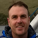
Dr Alex Rattray, Research Fellow with the School of Life and Environmental Sciences and Deakin Marine Mapping group, led by Associate Professor Daniel Ierodiaconou, said the project opened up opportunities for researchers to start putting together the bigger picture on marine habitats.
[testimonial_text]There are so many disparate data sets stored on servers within university and Government departments that are invisible and undocumented. The crux of the project has been to collect all this data, catalogue and archive it and then make it available for the broader science community.[/testimonial_text]
[testimonial_picture name=”Dr Alex Rattray” details=”Deakin Marine Mapping group”]
 [/testimonial_picture]
The collaboration has seen an Australian Ocean Data Network (AODN) infrastructure stack installed at Deakin to manage and distribute the data.
“Deakin is one of the biggest custodians of this kind of data in Victoria,” Dr Rattray said.
“We have the technology and tools, including next generation sonar technology, to go out and collect highly detailed marine data and the research expertise to interpret it.
“Now, with this project, we have a central place to store and access the data.”
He said the VMHM project had connected data collectors and researchers with experts in data archiving and accessibility, allowing existing data to be rescued for future generations of researchers.
“An enormous amount of data gets collected and delivered and then sits on old hard drives and servers until it eventually gets lost or becomes unusable,” Dr Rattray said.
“What we’re trying to do is preserve what we have now and make it available for researchers in the next century. There is a wealth of information about our seafloor and coastal ecosystems that is really on the brink of being lost.
“It’s just so important that we preserve these moments in time of what our ecosystems looked like because otherwise we won’t have any idea what we had and what’s changed.
“For instance, we have information backed up on VHS tape from government archives from the early 90s and beyond. We can still access it, but in another 10 years it might be impossible because technology is changing all the time.
“Deakin Library has dug up all sorts of old equipment – not just VHS players, but the cords and plugs that aren’t available anymore – so that we can digitise and preserve the data.
“These working links between researchers, research support and archival experts are incredibly important to make sure all this data is preserved for future research.”
Another of the project’s aims is to map marine habitats, bringing together physical data about the ocean floor with biological data to create inventories of marine ecosystems.
This type of data is recognised globally as the corner stone for marine spatial planning.
One of the data sets included in the project is a complete topographic model of the sea floor from Victoria’s coastline out to three nautical miles compiled from data collected by a number of institutions, including Deakin, Parks Victoria, Department of Environment, Land, Water and Planning, The Royal Australian Navy, Port of Melbourne and the CRC for Spatial Information.
“One of the things we’re behind with in the marine realm is natural resource assessment and inventory,” Dr Rattray explained.
“It’s relatively easy on land to work out how much forest we have compared to urban areas because we can use satellite information, but to gather the same sort of information about the sea floor we need to use sonar, underwater video and photographs and diver data sets that describe what actually lives on the sea floor.
“Compared with their onshore counterparts, marine managers are hamstrung by what they’re able to see or what information they can collate.
“Any information gained in that space is a really big step forward, especially when our coastal ecosystems are changing so rapidly.
“For example, our cold, nutrient rich water is getting warmer because the East Australian Current is moving south. As this warm water gets pushed further south year by year, we’re finding warm water species moving down and the cold water species aren’t doing so well.
“We are in one of the fastest ocean warming areas in the world and this data provides important snapshots in time that can allow us to assess change in these ecosystems,” he said.
“So while we’re experiencing huge environmental changes in our coastal ecosystems, we don’t really have a baseline data set describing how things were, or how things are now.
“One of the really big outcomes of this project will be that future researchers have a baseline to compare against when assessing change and directing management activities.”
Published by Deakin Research 17 August 2017