Deakin researchers are seeking to put a value on southern Australia’s underwater habitats, as part of the Global Mapping Ocean Wealth Program.
Initiated in 2014, the project has come to Australia for the first time, with researchers to investigate the wealth of waters in Port Phillip Bay, Westernport Bay and coastal areas in New South Wales, to get a grasp of the benefits people gain from the natural environment and improve management strategies.
Deakin University scientists from the Centre for Integrative Ecology, within the School of Life and Environmental Sciences, will lead the project, including underwater mapping specialist Dr Daniel Ierodiaconou, blue carbon expert Dr Peter Macreadie and conservation ecologist Dr Emily Nicholson.
The three-year project is funded by the Nature Conservancy, as part of its Great Southern Seascapes program, supported by The Thomas Foundation, HSBC Australia, Department of Primary Industries in NSW and the Ian Potter Foundation.
The project will also include economists, ecologists, modellers and habitat mapping experts.
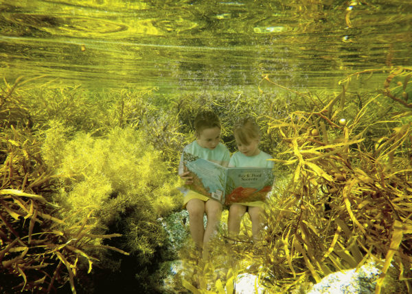
Dr Ierodiaconou said the project would consider the intrinsic benefits that habitats, including seagrass, saltmarsh, mangroves and reefs, provide for humans.
“By using high resolution data of habitat distribution, we can begin to quantitatively assess the values provided and make more informed management decisions,” Dr Ierodiaconou said.
The team will use spatial maps and other data to communicate the value of marine habitats to stakeholders, such as benefits they provide to coastal protection, fisheries, tourism and other recreational activities.
“We hope that this project will enable us to better understand the impact of alternative management scenarios and the trade-offs between services that these ecosystems provide,” Dr Ierodiaconou said.
“For example, we can evaluate the impact of an urban development in the coastal fringe and potential habitat loss in terms of reduced services, whether they be related to reduced nursery habitat for fishes, the ability to sequester carbon, or the provision of coastal protection.
“Alternatively, we can look at the potential gains that can be made in terms of restoration and prioritise localities that are likely to provide the greatest benefits in terms of services.
[testimonial_text]Coastal habitat loss is a huge problem globally and we often take for granted the benefits these ecosystems provide.[/testimonial_text]
[testimonial_picture name=”Dr Daniel Ierodiaconou” details=”Senior Lecturer In Aquatic Spatial”]
[/testimonial_picture]
By being able to map these habitats, the team hopes to be able to translate the findings in a way that helps decision-makers better understand the true value of the ocean environment.
“For example, a seagrass bed may provide coastal protection preventing beach erosion, provide an important nursery ground for fish and support diverse bird life, whilst expressing an aesthetic beauty supporting marine tourism,” said Dr Ierodiaconou.
“The diverse team will allow us to capture environmental, economic and social values that coastal marine habitats provide and identify specific areas of high conservation importance and opportunities to maximise return on restoration efforts.”
The Deakin researchers and collaborators have also secured additional funding from the Australian Research Council Linkage Program. The ARC project, led by Dr Macreadie, will research optimal management of coastal ecosystems for blue carbon sequestration, with project partners from the Nature Conservancy, Parks Victoria and Department of Environment, Land, Water and Planning (DELWP).
“The ARC funding will allow us to expand the work of Mapping Ocean Wealth by looking at the value of these coastal habitats in sequestering carbon. Seagrass, mangroves and saltmarsh are incredibly efficient carbon sinks. However, they are under threat due to urbanisation, rising sea levels and a changing climate,” Dr Ierodiaconou said.


